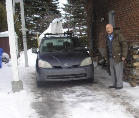
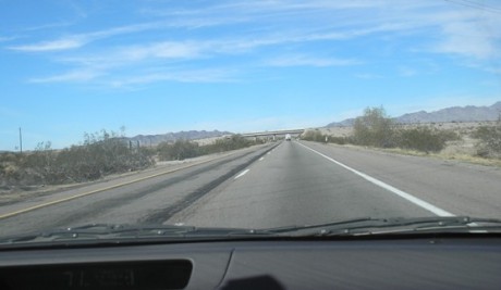
 The Chronometer reading on the dashboard is 92,290 miles.
We left home on Sun. Jan. 17 with our skis on the roof of the car. Our itinerary was to spend a month driving around the west and southwest of the United States without going anywhere we had been before. A relative-by-marriage in Pebble Beach, on the Pacific Ocean, had invited us to visit her and her husband, so that would be the midpoint of our trip. Her son lives in Santa Fe and she said we must drop in on him too. We emailed other friends to say we were on our way. Our last stop would be at our son’s home in Pittsburgh. We didn’t make any reservations because of the uncertain winter weather. We traveled up the Ottawa River on Rte 148, turned left at Shawville and crossed over to Ontario at Portage du Fort. The bridge at the Chenaux dam and hydro electric plant is pictured here. Then we got on the Trans Canada Hwy and headed northwest. Marg had gotten into a conversation with a retired truck driver on a recent bus trip to Toronto and he had told her that this route is good in winter, takes no longer than the superhighway via Toronto and Chicago and is very scenic. We had ski clothes with us, CAA guidebooks and maps, food and drinks, a blanket, an emergency kit, CDs and a first-aid kit. Although we had a cell phone, we knew it wouldn’t work in some remote spots. We were excited at the prospect of driving around the north shore of Lake Superior for the first time.
We stopped for lunch at Deep River, a lovely town made up of bungalows and stately pines. Just before Mattawa, the solid cloud blanket which had been covering the sky began to lift. Within 10 minutes, while we sped on, the sky turned completely blue and the sunshine bright. Past Sturgeon Falls it clouded over again.
 The initial part alongside the Ottawa River is flat, more agricultural, with few big trees but some big, prosperous-looking farms (my idea of ranches). There are many French Canadian settlements. The routes leading to links to places across the river in Quebec are identified by signs.
 We bypassed Sudbury to save time, even though we knew the stretch ahead was isolated and we were giving up our last sure chance of getting a good dinner at a reasonable hour.
Even the isolation was beautiful, with the highway becoming divided and the speed limit increasing from 90 to 100 kmph. Wide expanses of undriven snow stretched on either side in the darkness. The epitome of isolation is Whitefish. Don’t go there – go on to Jeremy’s crowded, apparently native-owned truck stop in Nairn and buy an expensive appetizer.
We arrived at the Mohawk Motel in Massey, a former lumber town. It’s heavily populated by tourists in summer because of the thousands of varieties of birds in the wetlands surrounding the north channel of Lake Huron.
And so to bed, after dining at The Dragonfly and watching the Tales of Hoffman on TFO. The motel receptionist told us this year the temperature was 30 degrees above normal. Still, we were awakened at 5 a.m. by the sound of someone chipping ice outside our door.
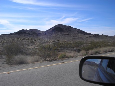
The drive around the north channel of Lake Huron mostly just gave glimpses of the water, Manitou Island and other islands, though we did get this picture at a wider opening. Blind River is a particularly pretty little town. Back in 1967, dynamiting for the Trans Canada’s construction exposed rock which geologists found to be two billion-years old. The Ripple Rock is 2.5 kilometres west of Desbarats and easy to miss despite its plaque. In fact we had to circle back. As we slowed down to look across at the rock from the car window, a shiver shook my spine. The shiny sandstone looks pristine and beautiful after all that passage of time, unbearable pressure and Himalayan-sized upheavals. The ripples are almost vertical, made by the waves of an ancient sea.
After lunch at the Soo we looked at the incredible engineering colossus of bridges, locks, dams, etc. linking the east and west of the continent, making international trade possible. We also drove around Roberta Bondar Park, built to celebrate the achievements of Canada’s first female astronaut. Traffic picked up near the intersection with Hwy 75 and the bridge to the US
After the Soo, the line of Laurentian hills we hadn’t seen since Mattawa re-appeared and circled the horizon. A lot of native people and Mennonites live around here.
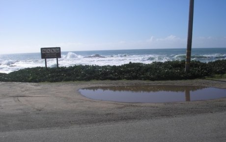
The forest exuberates with northern and jack pines, white birches, spruces and an unidentified spindly, top-knotted species of evergreen obviously designed by Dr. Seuss. Speaking of artists, the Group of Seven painted their landscapes near the Agawa Canyon, which can be reached by a summer fly-in from here. Much of the interior is parks and reserves. Yellow sign after yellow sign warned us to watch out for moose.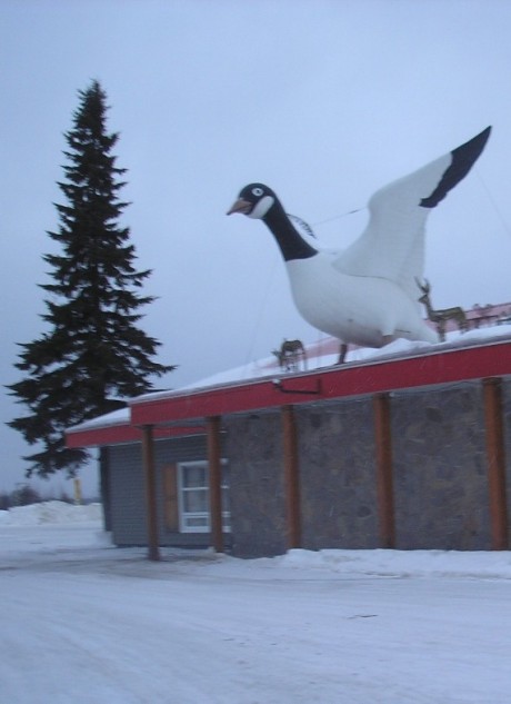 Up near Wawa, Lake Superior has beautiful sandy beaches, with waves whipped by huge winds. The highway was a velvety ribbon, with passing lanes and hardly any traffic. This town identifies with the Canada goose and has its image posted in the most unlikely spots.
Past Wawa the road hugs the shore and traverses the Adirondacks with fabulous vistas of Lake Superior, the biggest fresh-water lake on earth (350 mi. x 160 mi.). It was a warm day but around 5 p.m. it started to snow and the temperature sank. So did the sun, as we reached White River and bought gas around 6 at the first gas station we’d seen since the Soo. The owner and his wife both came out with squeegees to wash our windshield and wave us on with friendly smiles.
Darkness fell and we were tired but suddenly we saw a mass of brilliant lights shining on the right. It was the Barrick and Newmont gold mines, rivals standing practically side by side. This was an amazing, diamond-studded, incongruous sight. Employees’ cars were parked neatly in a lot, as if it were downtown Toronto.
We checked into a motel at Marathon after having travelled for 10 hours and covered 640 km. The clerk told us the town of 4,000 is angry at the Tenbec/Kruger pulp mill which laid off 230 workers a year ago. There is unrest and the scenic dock area, next to the mill, has been roped off. Pensions, benefits, are gone and it’s devastating, It was a comfort to eat at Wok with Chow, settle into a room with high-speed internet and watch the Australian Open.
 Lake Superior is the biggest fresh-water lake on earth. The views of it from the Trans Canada’s high elevations are so overwhelming, panoramic and magnificent that we didn’t stop to take pictures. Moose reign supreme. We didn’t see any but we continually saw footprints big and small in the snow among the rocks by the road. How can you fit huge islands, waters and mountains into a little lens? The towns, like White River and Schreiber, are small.
We crossed over the two-lane bridge at Nipigon, the only way to connect one half of Canada with the other without going through the United States. As of this update in Jan., 2016 a new bridge described as a “106 million dollar crown jewel by the National Post was opened two months ago but embarrassingly damaged when “a section of the cable-supported bridge deck suddenly split apart and heaved upward by 60 centimeters or more.” It has been reduced to one-lane traffic at the moment.
Thunder Bay is a wonderful, industrious city, poised high over its waterfront and Sleeping Giant Rock and Pie Island. We took a picture of the Terry Fox statue (such a sad story) and ate at a Finnish restaurant, Hoito (meaning care). Tom had thin pancakes that were like Hungarian ones. I had salt fish (smoked salmon which doesn’t look or taste like ours), mashed potatoes and viili (clabbered milk – like yogurt but better). On the way out, we weighed ourselves on the standing scales which looked like they’d been a fixture since the restaurant opened in 1910 to meet the social needs of Finnish lumbermen and families.
 We crossed the border at Pigeon Point. The agents were pleasant but thorough – couldn’t get over our multiple destinations. They found a kiwi rolling around on the floor and took it.
Duluth was dark by the time we arrived but we happened onto the scenic route, which puts Ottawa’s Driveway to shame. They have 49 miles of docking and are a centre for mining and lumber exports. Also they have ski hills practically downtown. On the way into the city on Hwy 61 several deer crossed the road in front of us, many white birch grew on the hillsides and three modern tunnels let the road burrow through mountains of rock. This whole highway hugs the Lake Superior shoreline and was beautiful at sunset.
We stayed at the Americinn in Moose Lake and Tom swam but I didn’t, since the lock on our door didn’t work. It’s a nice hunting lodge-like hotel right on I-35, and it cost only $69.99.
Day 4 – Wed., Jan. 20, 93450 mi.
Moose Lake, MN to Des Moines, IA
 (Photo credit Minneapolis Institute of Art)
We drove straight to Minneapolis in clear weather through flat, snow-covered farmland. Lots of modest-size evergreen trees and a species of deciduous tree whose leaves turn brown but don’t fall off lined the I-35. Minneapolis was windy and felt even colder than Ottawa. We headed for the Institute of Art and, for Tom, seeing their Tatra, a Czech V8-engine car made in the 1930’s was worth the whole trip. The paintings and furniture designs weren’t bad either. We lunched in the Museum’s restaurant and bought postcards.
An ice storm was in progress in the vicinity of our next destination, Des Moines, so we drove for the next five hours slowly and apprehensively. The wind was strong from our left, freezing rain fell sporadically and, while I drove, Tom gave me a refresher course in all the skills he knew for avoiding a skid if we suddenly hit ice. We could see the worst was over, judging by the overturned transport on the median (fortunately a wide one) and six SUV’s abandoned there or in the ditch. The temperature was 28° F but about 45 minutes before we arrived in Des Moines it rose to 32° and stayed there.
The landscape was so flat, open, white and unpopulated that you couldn’t find the divide between snowy land and cloudy sky – except for little tufts of brush sticking up here and there. All the big trees were beautifully glazed. There were no signs of life; the farmers must have all been down south watching the ball players practice. Towns are few and far between and there are no services along the way.
 We reached Des Moines after dark, bypassed it and checked into the Courtyard Marriott on the southern periphery. It’s new, gorgeous, a bit above our budget. At a great restaurant, Chez Mimi’s, across the street we ate pot roast for dinner.
Day 5, Jan. 21, 93439 Des Moines, IA to Kansas City, MO to Wichita and Pratt, KA
We left our luxury suite at the Courtyard Marriott in our ski jackets, with ice underfoot. Going south on I-35 the effects of the severe ice storm for the first hundred miles made it look like Ottawa after the great ice storm, with all the trees glazed over and four cars or SUVs abandoned. The land was very flat and snow-covered. Temperature was 36 and went up to 41 but still felt bitter cold as Ottawa because of the wind. The style of bridges and overpasses and the colour and lettering of road signs is identical to those in Canada.
Kansas City was originally named Possum Trot and is two cities – one in Missouri and one in Kansas – that have a joint economy. It has scenic drives and many fountains which we didn’t see because we followed the CAA guidebook instructions to get us directly from the interstate to the Nelson/Atkins Museum of Art for lunch. We climbed the marble staircase and looked at fantastic Flemish Lynviers tapestries of the Phaeton myth.
Lunch in the Rozelle Courtyard Restaurant was exceptionally warm and friendly as we were surrounded by ‘merry widows’ eating close to the baroque fountain. They had a display table showing what the dishes on the menu looked like. But when you took your tray over to the counter to order what you wanted, they were out of the best-looking ones! We enjoyed looking at just a fraction of the fantastic collection of paintings and sculptures.
This Museum is located in a neighbourhood of old mansions, all made of fieldstone or else having fieldstone chimneys, pillars, fences, etc. We saw our first one or two black people, such as our busboy at lunchtime.
At Wichita (originally called Cowtown) we took the turn onto Hwy 54 to go west, instead of south. It was very flat prairie, treeless, and not-too-interesting until we got lost near Emporia trying to buy stamps. We landed at what must be the farm Dorothy got blown out of in the Wizard of Oz. The acres of plowed soil surrounding it were very heavy black loam.
Back on the highway we went through the Flint Hills of cowboy country, with dark earth, little oases with a few trees, limestone and Angus cattle grazing. A few cowboy restaurants appeared.
It’s environmental shock for an easterner, it’s all so different.
It got foggy at dusk so Tom drove slowly and we found a room at the Regency Suites in Pratt. We had dinner at the Uptown Cafe/Club de l’Est which has movie posters on the wall and such broken-down booth seats (we tried three) we could barely reach the table tops.
We were a bit concerned about all the bad El Nino weather out there. We hoped we’d be lucky enough to keep on avoiding it and enjoyed swimming in the hotel’s very warm pool.
Day 6, Fri. Jan. 22, 94370 Pratt, KS to Dodge City and Liberal, KS, Tucumcari and Santa Rosa, NM
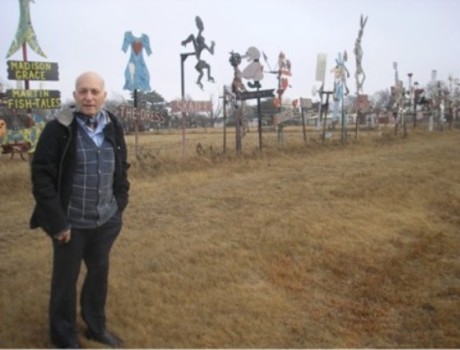 We left Pratt and traveled in fog most of the way to Mullinville which was on the detour to Dodge City, our fun for the day. I took a picture of Tom with some of the miles of roadside pop art growing out of the tall grass at Mullinville.
Dodge City is great fun and cashes in on its notoriety as ‘The Wickedest Little Town on Earth’. Tourists enjoy the illustrated historical posters outside this authentic line of stores, the setting for many western movies. Gunsmoke Street is located here and Boot Hill Cemetery. Marg posed with Wyatt Earp’s statue and we bought postcards saying, ‘Get out of Dodge’.
 After having lunch in Liberal, KS we started the long diagonal cut across Oklahoma and Texas, where few people live, for good reason. It is so dry that even the bridge over the Arkansas River spanned a dry bed. The road was good, the land flat as a runway and the wind and tumbleweeds were out in full force. We were fascinated by the big sky and types of rocks and plants. There were a few signs of prosperity (oil rigs, cattle, farmers’ co-ops, utilities and chemical plants) but more of desperation (abandoned or rundown shacks).
The temperature climbed from 38 F when we started out to 68 F. Then it began to fall as mountains (foothills) came into view in the distance.
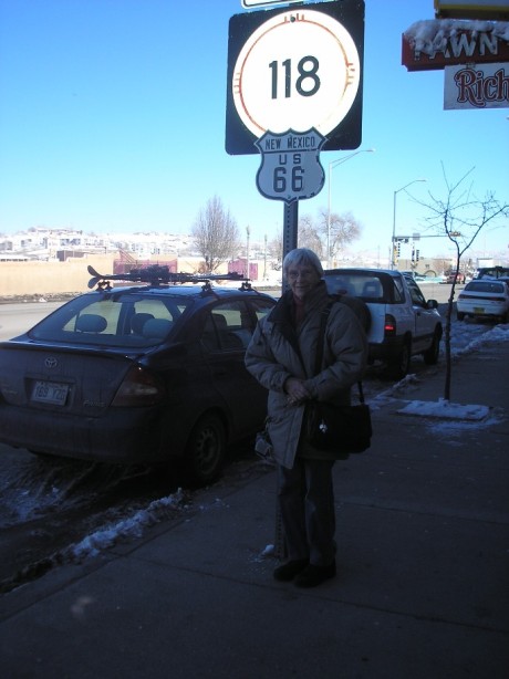
 When we entered New Mexico we set our clocks back an hour and also crossed the continental divide. Tucumcari has its own spectacular little mountain which was used by the Comanches as a lookout. Here we got on I-40. The famous route 66 started here and is still identified and lined with ‘museum’ motels and cafes, signs, names and 50’s and 60’s nostalgia. What we saw, on a drive-through and gas stop, was sinister characters speeding around in souped-up cars while many of the homes and would-be businesses show signs of abject poverty. Outside town three trains finally went by us on the Achison/Topeka/Santa Fe line we’d been driving parallel to for two days.
We were puzzled by the redness of the rocks, earth and highway and were thrilled to pass a canyon just before we entered Santa Rosa, NM and found a room for the night.
Day 7, Sat. Jan. 23 945440 Santa Rosa to Santa Fe
The ‘mother’ who manages the breakfast room at the Comfort Inn took great pride in satisfying us and told us they had earned 93% on a recent inspection. Another couple were very friendly, welcomed us to their country and said they were going to visit friends in Tucson, AZ who had just phoned to warn them they had had an almost torrential rainstorm.
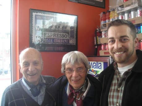 Here we are with Adam Kokesh in the Tribes Restaurant in Santa Fe, NM, since we’d promised his Montreal-born and -raised mother we’d contact him. On the wall is an enlargement of an Italian stamp honouring espresso, which we thought was a good idea. Adam was taking time out from a very busy campaign to get the Republican nomination for the congressional race in November. As you can see, he’s a nice guy, 25 years old. He served two tours of duty in Iraq, completed a university degree and then became an anti-war activist. He’s passionate about the libertarian ideals of Ron Paul, who is his mentor. We didn’t talk politics, we just had a nice family visit and lunch (with espresso and capuccino). He jumped up a couple of times to shake hands with good prospects and give them a card.
As soon as we came into the restaurant, Tom plugged in our laptop computer and turned on Skype. Almost immediately it started signalling. It was our son, Leslie, in Pittsburgh calling. We turned the computer around so he would be surprised by seeing Adam, not us, and they had a good talk. Traveling around no longer isolates people the way it used to!
After saying goodbye to Adam we went to our B&B, a 100-year-old one called Casa del Toro, which we found out about on the internet. It is near the town plaza and the road to the ski resort.
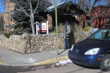 This ‘Adobe Abode’ was up for sale on the street where we stayed.
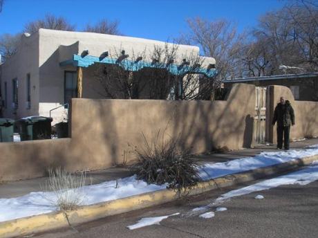
Here is another typical adobe house, just around the corner from our B&B.
 Paul Phillips, our host, outlined a walking tour of the Old Town for us and we were enchanted. This city is a gem for its atmosphere, architecture and friendly people. Even though it was Saturday night and businesses were closed, we admired the soft-looking, curvaceous buildings, the Governors’ Palace, the old Cathedral, the museums and many artists’ galleries and artisans’ shops all full of beautiful wares. Santa Fe is the biggest art market in the world, after Paris and New York.
As if that wasn’t enough for one day, the waiter at The Shed Restaurant suggested we were ordering too much and brought just one order and an extra plate ($1.50 instead of $13.95.)
We love Santa Fe and quite liked our first encounters with New Mexican cuisine. Tom was enthralled by the adobe buildings. They are a rosy sand colour, with rounded corners and slanted uprights such as we just don’t see here. We were also fascinated by the shrubby, stunted evergreens we passed driving in to Santa Fe. Some are pinyons, which produce pine nuts, and others are junipers, which produce berries.
The gourmet breakfast we enjoyed next morning with other guests at the Casa was cooked by a woman who used to live in Ottawa. Perhaps she was a diplomat’s wife.
 Day 8 Sun., Jan. 24 Santa Fe to Albuquerque to Grants, NM
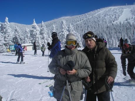
The 16-mile drive up the mountain to Ski Santa Fe was breath-taking. We parked and a shuttle bus took us on up. Loads of skiers, particularly families were there. Tickets cost $40 but a nice surprise for us was that anyone over 72 doesn’t have to pay!
We rode the chairlift up to an elevation of 11,250 ft and I was feeling pooped just from getting there. However, the snow was beautiful and conditions not difficult. After two runs we had lunch and then did two runs more, feeling better. We figured it takes time to get used to the thinner air. This is a fabulous resort, an almost hidden jewel except for the locals.
We reluctantly said good-bye to Santa Fe but prolonged our new love affair with New Mexico by stopping in Albuquerque to walk around the Old Town with its adobe architecture and churches. Everything closes at 6 p.m. I left my black gloves in the public washroom and the cleaning woman looked very frightened of me. We window-shopped outside beautiful artists’ studios, walked through sinister alleyways featuring posters of outlaws and had a good dinner at La Hacienda. They call the separate red and green hot pepper sauces ‘Christmas’. The waiter took our picture.
Then we drove on to Grants, an old uranium town, to sleep at the Comfort Inn.
Day 9, Mon. Jan. 25 9472 Grants and Gallup, NM to Flagstaff and Williams, AZ
 We shopped at the Continental Divide Indian Village gift shop. That wasn’t enough so we also stopped in Gallup at Richardson’s Trading Post on Rte 66, where a very friendly retired banker, Mark King, served us. It’s a marvellous store and I suspect their pawn shop dimension does well in these times. It was his 61st birthday and he says he usually goes out with his metal detector but this year it is too cold – 20 degrees below normal temperatures. He just works three days a week because of business slowdown. He was very happy that we bought three silver knives ($75 each) and four beaded bookmarks ($4.99 each) and showed his appreciation by offering the use of his ‘very clean’ washrooms. An employee showed us the way, through a stockroom containing 23,000 saddles.
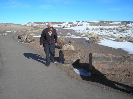 Mr. King advised us to look at the painted earth and petrified forest in the National Petrified Forest Park as we drove on, which we did and took pictures.
We drove on to Flagstaff, which was a cranky town I think because the traffic was a terrible mess due to all the snow that had fallen the week before. We went up the road towards the Grand Canyon but after 20 miles had to turn back because the road was closed. 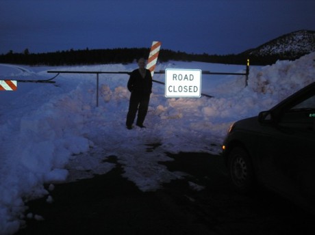 Then we knew that we had to give up on this part of our trip or else be late for our visit with Kathy and Norman Brown. We drove on to spend the night at the Travelodge in Williams. The room heater didn’t work, since it was pulling in outside air, but the owner provided two space heaters and extra blankets. We had dinner at Pine Country and looked at their art gallery of pictures of the Grand Canyon and their craft items for sale. This is really cowboy movie country. Nearby was Gunsmoke St and ‘Miss Kitty’s’ steak restaurant.
Day 10, Tues. Jan. 26 95073 Williams to Kingman, AZ to Needles, Barstow, and Bakersfield, CA
We put away our ski clothes and left the ice and funny snowbanks (they were drying slowly in craggy shapes, like the mountain rocks) of Williams. The hwy had potholes but the big transports had a slower speed limit (55 mph compared to 75 mph for cars) and a separate lane so we came quickly, looking at the unusual rock formations and ‘high and dry’ plants. First it was semi-desert, then the full-blown Mojave desert. (We took pictures of the San Bernardino County and Mojave deserts).
 Always with mountains in the distance, we also passed smaller dark gray corrugated ones, peach-coloured, pink and red ones, straight-cut or slanted ones, huge piles of stones – you name it, and the shapes, shades and sizes were all awe-inspiring and new to us. The desert is ugly and pathetic but the temperature rose to 59 degrees,
At Needles the scenery improved with the addition of palm trees. We took pictures at McDonald’s, where we stopped for coffee. The sun was shining and we were in California!
 Driving along, we saw the pavement turn purple.
Around Barstow, on route 66, we saw some very poor shacks and not much mining activity. We crossed a high bridge over the Colorado River. Barstow is not doing well economically now. It is trying to live in the past because of its rte 66 prominence and the fact that it was the locale for many, many movies.
We saw black hills and fields, but not black earth. We figured it had to be oil shale. In the desert we encountered the first rain we have had since leaving home. The clumpy grass was brown and dry.
The last 40 miles before reaching Bakersfield was an absolutely stunning drive, up and down from very high elevations. We felt the pressure in our ears. Getting close to the city, the huge, rolling hills were all covered with green, green grass with not a tree in sight.
At the Red Lion Inn we had dinner, set our clocks forward another hour, did our bag of laundry by walking a mile back and forth outdoors to the laundry room five times and went to bed tired.
Wed., Jan. 27, Day 11 95550 Bakersfield to Springville, CA
Drove up hwys 99, 65, 190 to Springville, CA. Saw oil rigs pumping. Oranges and grapefruit were ripe in the groves lining the road. Palm trees. Snow-capped Sierra mountains in distance. Flat fields, some plowed, some covered with very green grass. Some deciduous trees were bearing leaves, others weren’t, as if there was no consensus on the season. Saw different varieties of evergreens as we drove parallel to the Sequoia National Forest. Cattle grazing.
Near Springville the land became very hilly but was still green. Lots of exposed boulders, trees and foot paths on the hills. Beautiful countryside like we’ve never seen before. Springville is a charming town; nature has endowed it like a fantasy park.
 We traveled a winding road into Kathy and Norman Brown’s place, past ranches and country homes. They have a beautiful, big house.
Kathy looks after songbirds and cats galore. She has bird feeders ($30 a month for niger seed for one of them ‘alone) to attract gold finches, purple-breasted finches, nuthatches, etc. She’s not so fond of the woodpeckers, who eat holes in the house, or the blue jays who frighten off the songbirds. Kathy has a 12-year-old Labrador dog, Sadie. Lunch was a delicious chicken casserole, salad and freshly grown oranges and Kathy kept the fire burning. Dinner was yummy poached salmon, spinach fertada, rice, salad and raspberry torte. The feral cats feeding on the deck (she had eight that day) control the rodents who would otherwise attract rattlesnakes. Coyotes, mountain lions, wild pigs and bears also live in the area.
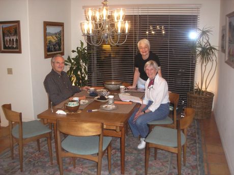
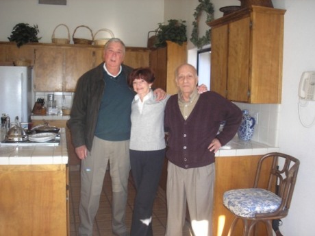 We had a good conversation with Norm about WW II, his background, the school district where he has had a long career as teacher, principal and consultant, the local Indian population, etc. He wants me to send him a copy of my book. In summer he climbs the nearby green mountains/hills with friends, a pack mule to carry supplies and a gun. When Norm appeared, the first thing he did was to thank Tom for having established a connection with Kathy. We had brought Kathy an unusual leaded-glass dish made in Germany by Nachtman. One way up it is a platter, the other way on top there is a little bowl for a dip. She liked it a lot.
Thurs. Jan. 28, Day 12 95626 Springville to Pebble Beach, CA
We traveled rtes 99, 198, 5, 156 and 101. Much of the landscape we drove through reminded us of Ontario – grass, green crops growing, plowed fields, good-sized trees. Saw signs saying ‘Congress-created Dust Bowl” and “No water, no jobs.” We passed the large San Luis reservoir. Horrible sight on hwy 5 was a cattle station where thousands of cattle were gathered with nothing to feed on, just lolling about creating a terrible stink. Not much farther on we saw herds of sheep peacefully grazing.
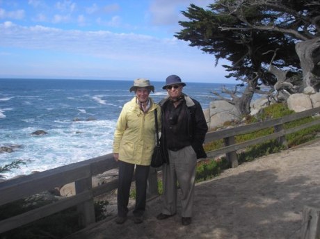
 The drive over the mountains to Gilroy was fabulous. We drove around Monterey a bit and saw the Pacific Ocean for the first time. In the town of Marina we bought yellow potted orchids for Barbara Von Gehr. We paid $9.25 at the toll gate entering the scenic parkway through Pebble Beach but got lost so had to phone Barbara, who came and got us. Then she and George took us to their Country Club for an excellent dinner (I had pork chops and Tom had Mexican food). George drove us along the ocean front in the dusk. We could see big waves and will explore more to-morrow. Barbara showed us their huge house and her collection of snow globes/music boxes. She wants us to buy her one from Ottawa.
Got an email from Sandra. We watched the Australian Open tennis tournament.
 Fri. Jan. 29, Day 13
Had breakfast with George and Barbara (grapefruit, scrambled eggs, toast, capuccino or espresso), then Tom and I took off to spend the morning looking at the ocean from points all along the scenic drive. Saw the ghost tree, the lone cypress, white cranes (we think), cormorants. It was a clear windy day but we saw one surfer near shore and several big boats in the distance. The water was a beautiful turquoise colour and the roar of the waves was like a train. The rocks and islands near shore are very rugged but we saw no sign of seals or sea lions who often congregate on them. We saw a huge eucalyptus tree. Lots of other visitors were at the lookouts, taking in the awesome beauty of the sights. We went down on one of the sandy beaches and got our hands (and shoes!) wet in the ocean.
George and Barbara took us to their Tennis Club for lunch but this time Tom paid (tomato/bean soup and Asiatic chicken salad). We sat at a table near the window with an excellent view of the ocean but by now the sky and water were gray. The hostess had lived in Toronto and had been to Montreal for Expo 67.
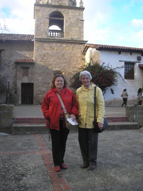
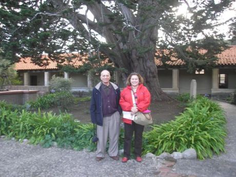 After lunch Barbara drove Tom and me around the town of Carmel where we saw movie stars’ houses (Kim Novak, Clint Eastwood – he was mayor here), quaint little houses and businesses with moss-coated cedar shingle roofs, beautiful lawns, flowers, shrubs and trees, birds etc. We stopped at the historic Carmel mission for a self-guided tour of the church, museums, gardens, cemetery and courtyards. We took pictures of ourselves with the bougainvillia and a huge cypress tree.
 We then went to Monterey to look at the old Cannery Row (written about by John Steinbeck) and heritage architecture (northern California Colonial). Then Barbara took us to the Spanish Inn Hotel which had been a favorite haunt of Liselotte’s for a capuccino, served in the lobby beside the fire. Each day at nightfall a bagpiper plays, so we went out to listen and take a photograph. This is a links golf course and in Scotland, at every links golf course, this is the custom.
Barbara cooked us a lovely dinner of Alaskan salmon, asparagus and salad. Then she looked at our pictures and we looked at hers of their recent trip to Australia.
Day 14, Sat. Jan. 30 Pebble Beach to San Francisco
 It was a beautiful sunny day for the drive up hwy 1 to San Francisco. Before we left Barbara gave us breakfast (grapefruit, scrambled eggs, toast, capuccino or expresso). She asked Tom a lot of questions about her family’s history and I gave her a floating candle (a hostess gift from Aylmer) which she will use in their courtyard jacuzzi.
We drove past fantastic vistas of the ocean and discovered the names of some of the bird species: brown pelicans, white pelicans, scoters, California gulls, godwits and cormorants. We stopped at a lighthouse and overheard someone saying he had seen an elephant seal but we had no such luck. Hwy 1 went through towns with pretty-coloured homes, past ominous-looking sandy cliffs that were cordoned off at the bottom for fear of land and rock slides onto the highway, and slalomed over exciting, narrow, mountain passes. The trip took much longer than the two hours predicted because traffic was heavy and as slow as 25 mph through some towns. We got a little lost once or twice and stopped to take pictures of some of the awesome views.
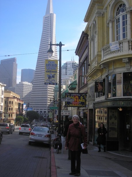
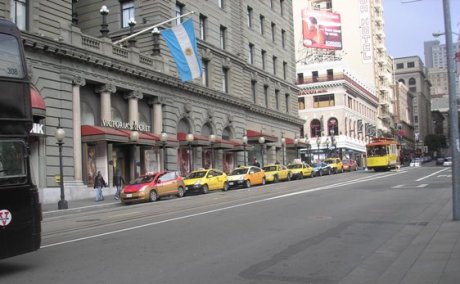 San Francisco is very scenic, the row homes are colourful, tidy and beautiful and the street cars are quaint. Priuses have taken over this city – even the taxis.
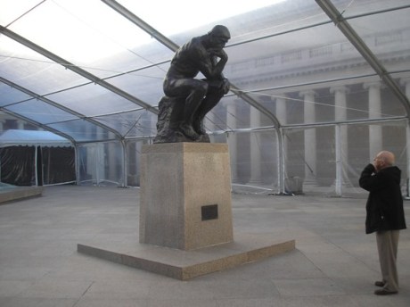
We went straight to the Legion of Honor fine arts museum for lunch and a look at its impressive medieval and baroque European collection of paintings and sculptures by the masters (eg. Giotto, Giovanni, Titian, Tintoretto, El Greco, Cellini, Rembrandt, Rubens, Van Eyck, Van Hals). In the outside entrance courtyard ‘The Thinker’ by Rodin was all alone until we took pictures of each other with him.
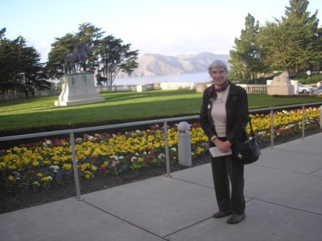
 We also took pictures of the building, which is a three-quarter size replica of the Legion of Honor palace in Paris, and photographed the Golden Gate bridge in the distance.
We then drove along El Camino Del Mar Drive along the oceanfront, past bicyclists, beaches, sailboats and surfers, to Fisherman’s Wharf. This is a huge area, like the Byward Market ten times over, with dozens of seafood restaurants and some old ships to see, Ripley’s Believe It or Not Museum, a wax museum and a submarine. You also get a startling view of Alcatraz Island and can even take a ferry over to see it. Apparently Fisherman’s Wharf used to have a lot of sea lions lolling around but they have moved a few blocks away.
 We followed Embarcadero Drive to the downtown area and found a room at the Galleria Park Hotel for the night. For dinner we walked over to an alleyway with six restaurants in it and hostesses trying to get us to come in. After walking down the line, getting the menu spiel from a hostess at each, we chose an Italian restaurant and ate outside under the warmth of a heater suspended above. It was hard to believe this is January. The dinner (rolls with pesto, baby spinach salad and crispy chicken cooked with a brick pressed on top of it) was simple and delicious and cost $60. We had a wonderful time reliving what we used to do when we travelled abroad in our Bohemian salad days.
Day 15, Sun. Jan 31 San Francisco
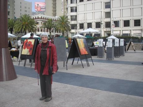
We walked to Union Square (pix) and had breakfast of pannini with egg and tomato, the best orange juice we have ever tasted and coffee at the Emporio Rulli, Temperature was in the 50° F’s and the doors opened onto a big art exhibition in the square and all kinds of blooming shrubs and trees. Huge stores (Macy’s, Saks, Neiman Marcus) look onto the square, as does the Westin St Francis Hotel.
The morning after the 1906 earthquake the chef served breakfast to anybody who had survived out in the square. We looked at the hotel’s antique, not-ticking grandfather clock – apparently there’s a famous saying, “Meet me at the St. Francis.” We took pictures of taxis and streetcars, etc.
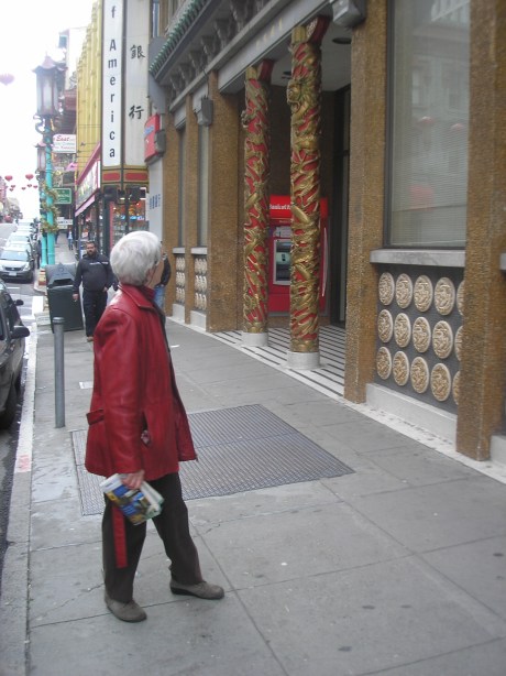
We looked at the little brick Frank Lloyd Wright building on Maiden Lane, which was a prototype for the Guggenheim in New York.Next we walked around Chinatown and were offered huge bargains in furniture and chandeliers. Too bad we couldn’t carry them back to Aylmer and their Free Delivery applied only to the States!We also saw St Mary’s Cathedral, the St Francis of Assisi shrine and skyscrapers in the financial district.
 We had coffee at Cafe de la Presse and went into the City Lights Bookstore, which is on a corner where Beat poets like Jack Kerouac hung out in the 60’s. The man who started this bookstore invented the paperback. I left one of my books there on consignment, just for fun. Tom took lots of pictures – e.g. of the ‘pyramid’ skyscraper.
At noon we checked out of the hotel but our parking was still valid until 7 p.m.We ate a late Chinese lunch and were on our way back to Pebble Beach shortly after 4. However, we couldn’t leave San Francisco without Tom’s driving the Prius down Lombard Street, the crookedest street in the world. It was hair-raising.This is a great town with a great climate. The people all wear jeans everywhere. They’re not openly friendly but go about their business with big-city reserve (almost like us!)
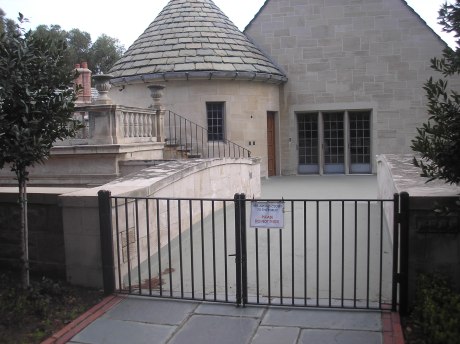
 This is what the entrance to a very exclusive ‘movie star’ dream house called ‘Heaven Can Wait’ looks like from outside!
Mon., Feb. 1, Day 16 Pebble Beach to Woodland Hills
We drove US I on its narrow ribbon between what seemed like mile-high mountains on the left and a mile-long drop to the sea on the right, The twists and turns and the breath-taking scenery did not let up for three hours. The speed limit was 65 mph but every quarter mile or so were signs warning to slow down to 25 mph in the curves. To add to the drama, one lane of the two-lane way was closed in a number of places while crews cleaned up the debris from rock slides. The weather was clear. We found out that Big Sur refers to a 29-mile ridge along a particularly scenic stretch. We stopped at the visitor centre of William Randolph Hearst’s castle at San Simeon. It is hyped up as a major tourist attraction but holds little of real value so we just took a look through the telescopes to satisfy our curiosity. It is one man’s fantasy built on an 80,000-acre mountainous cattle farm.
We had lunch at Cambria, after the land flattened out, and Tom took over the driving. It was obvious that we were in southern California instead of northern California. Apparently there is quite a cultural divide, as if they were two states.
 In Santa Barbara we visited my (Marg’s) Victoria College friend Kathie Ross and her husband Ted in their beautiful home which looks out over the Santa Inez hills. Their garden contains orange and lemon trees, rosemary hedges, palm trees, agave plants, cacti, etc, They said the beautiful home across from them had been abandoned, was boarded up and no one wanted to buy it. Ted’s art work adorns the walls and he told Tom he spent 60,000 hours making a model tank. We reminisced and talked about our kids and grandkids over tea and brownies. Their eldest son, age 54, has hepatitis and cannot work so they are supporting him and his family and can no longer afford to go on cruises.
After dark we drove on and got a room at the Holiday Inn about 20 minutes north of Los Angeles. We ate a very good dinner of cornish hen with rice and salad at a Persian restaurant called Knob Hill.
Tues., Feb. 2, Day 17
We ate a $26 breakfast at the hotel, then drove to Los Angeles and checked into the vintage Hollywood Heights Hotel which has nice black and white photos on the lobby walls of movie stars who stayed here, like Cary Grant, Bette Davis and Humphrey Bogart.
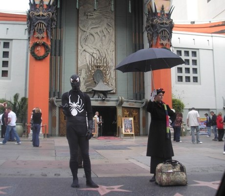 Daisy Gerber came with her car and her sister Maio and we went to see the Walk of Fame, where movie characters such as Superman, Spiderman, Mary Poppins and Charlie Chaplin mingled with the crowd in front of the theatres.
In the souvenir shops on Hollywood Blvd. Marg bought a Rte 66 carpet bag she has carried ever since, and a ‘Ski Utah’ licence plate we had been trying to find ever since we skied in Park City a few years back. We didn’t go on a studio tour but that was the fault of our itinerary, not of the hucksters who were out on the sidewalk selling tickets persuasively for them.
Then we saw Rodeo Drive, the upscale shops on Wiltshire Blvd and Sunset Strip, where we had lunch.
 Daisy drove us around Beverly Hills, where we saw Dr. Spock’s home and then Greystone Mansion, where Daisy went to school and worked. The gardens had beautiful palm trees, lavender hedges, cacti, and blooming flowers such as camelias, poinsettias, bougainvillia, petunias and many other species we don’t know. It was pretty summery, with the temperature above 60 degrees and smog in the distance downtown.
Maio and her husband Gabor invited us all to their home for a wonderful home-cooked Hungarian dinner of porkolt, dumplings, gherkins, bread, wine, tangerines freshly picked from their garden, walnut roll, tea and coffee. He showed Tom his outdoor swimming pool and gave him a kumquat from his garden.
Daisy and Maio were childhood friends of Tom’s who fled Hungary in 1956. Their father, Imre Gerber, was Tom’s father’s partner in the hosiery factory. There was lots to talk about and we all had a good time.
 Daisy is sweet and generous. She gave us gifts (a calendar, marzipan, fragrant soap) and wouldn’t let us pay for lunch. I gave her a floating candle.
Wed., Feb. 3, Day 18 96565 Los Angelos to Yuma to El Centro
We swam in the outdoor rooftop pool at the Hollywood Heights Hotel and soaked in the hot tub. We drove around downtown LA to see some of the spectacular skyscrapers and other buildings, such as the Walt Disney Center. Then we left via 7th St and Alameda St. We stopped at a McDonald’s and tried unsuccessfully to phone Freddie Fishell.
We stayed on Alameda – a wide, flat, lightly-travelled, 40 mph route – all the way to the end of it and then crossed the bridge to Long Beach Island at San Pedro. Alameda was very interesting because of the endless number of auto glass and auto parts businesses stretching for many miles, all on the same side of the road. The bridge and Long Beach Harbour are massive and incredibly busy with oil rigs pumping and huge cranes lifting containers onto trains.
San Pedro is a beautiful, affluent-looking, hilly retirement community with Spanish architecture and red-tiled roofs. We had lunch (a beef sandwich for Tom and a vegetarian one for me) at JTrani’s Restaurant and the owner gave us directions for getting on I-405 to San Diego. It’s built up until just north of the city. The land is semi-desert with mountains in the distance to the east and lovely sandy beaches. We drove right through the heart of the city without stopping, admiring the huge palm trees, flowers and Spanish-looking tiled-roofed houses on hills.
Now the drive became interesting. We had no idea what we were in for and didn’t buy gas. The land is desert-like with an ominous mountain range to the south to keep out any would-be penetrators from Mexico. The elevation goes up to about 4,500 ft at the Tecate continental divide. Only Indian reservations inhabit the area. The unbelievably long, twisty drive down to lower elevations went on for 30 or so miles. We knew we were sort of low on gas but there was no place to buy it. Once a gas pump pictogram appeared but it was a false lead. Finally, we got to an Indian-owned casino and truck stop and filled up. The tank took 9.8 U.S. gallons and its capacity is 10 Imp. gallons.
We got a hotel room at Comfort Inn in El Centro, which is at –45 ft elevation. We could smell manure in the air and helicopters were flying in low to the air force base nearby but this was home sweet home for to-night. We swam in the very warm pool and, in addition, soaked in the hot tub.
We left the cable behind at our last hotel so couldn’t make Skype calls on our computer.
Thurs., Feb. 4, Day 19 El Centro to Casa Grande 96849
 We bought hub caps and oranges near our room at the Comfort Inn in El Centro. This is a growing and distribution centre for a large area. The alluvial plain is very black and fertile and has irrigation too. The oranges just cost 33 cents a pound. Then we drove on Hwy I-8 to Yuma. It is desert countryside but the town has a very scenic mountain backdrop. We had lunch at Brownie’s Cafe, where a barbershop quartet, the Celltones, dropped by and serenaded everyone with ‘Let Me Call You Sweetheart’. Tom ran and got his camera and took a picture of me singing with them.
We missed seeing Gene and Duane Massett because, unfortunately we couldn’t get our computer hook-up to work the night before so they didn’t know in time that we were coming. However, we drove out to see their RV park and other residents showed us where they lived so we could leave a card. Gene called me when they got home and we had a nice conversation but by then we were an hour out on the road to Tucson. She advised us to see the aviation museum there but we didn’t have time. Before we left Yuma we drove over the historic Ocean to Ocean bridge spanning the Colorado River.
We had hoped to get all the way to Tucson but decided instead to find a hotel room at Casa Grande because we lost an hour due to the change to mountain time. The countryside was desert and we faced a chain of mountains which hwy I-8 wended its way through and over without any really big inclines or declines. It’s amazing that there’s a major citrus-growing area farther along, due to an irrigation channel, I think. The border guards, with German shepherds, were stopping all cars for inspection but waved us along. As we got closer to Casa Grande we were surrounded by sand dunes on either side, just like the Sahara desert.
Thank goodness, we had no trouble getting online in our room at the Travelodge – and we were greeted by emails and Skype calls from our kids! It helps us not to get homesick and it’s good to know that everyone is OK.
Friday, Feb. 6, Day 20 97503 Casa Grande to Tucson to El Paso
The CAA prepared a TripTik binder-book-map for the portion of our trip from here on in and we are finding it very convenient to follow. The plains of the Salt River Valley are irrigated so we saw green leafy vegetables growing and signs advertising pecan, pistachio and walnut crops. There was not much settlement, except flat-topped adobe houses or more expensive ones with clay-tile slanted roofs on the outskirts of towns. The mountains are numerous and scenic. The desert plants are dry, squat and scruffy even ‘though this is the rainy season and some of them were sitting in water. Tucson is a picture-postcard-perfect Arizona town surrounded by mountains – one or two of them snow-capped.
The road was wide and the median was a big desert in itself. Practically all day we were crossing the Texas Canyon summit and the continental divide but the rise and fall were gradual, even though we started at 0 and went up to 4,500 feet. We played music because desert and distant mountains can become a little monotonous after several hours of them.
We ate brunch in Tucson and browsed in an outdoor market of desert mineral gems, fossils, pottery, Persian carpets, jewellery, clothing, handbags, etc. but didn’t buy. Then we stopped at the Indian souvenir shop at the continental divide but found everything there was made in China.
 El Paso is another gorgeous town, surrounded by mountains and with several bridges over the Rio Grande to Mexico. We checked into the Comfort Inn and felt safely removed from whatever drug/immigration unrest may be taking place not far away. We had a very good, inexpensive dinner at La Malinche Mexican restaurant, a chain in this area.
Sat. Feb. 6, Day 21 97503 El Paso to Pecos, Odessa, Midland, Sweetwater
We shopped in El Paso’s Golden Horseshoe, near the Port of Entry with Mexico.
 We left at 12:30 and drove all day on I–10 and then I–20 through Texas. Although there are mountains and mountain chains to look at, it is not a beautiful state because of the semi-desert conditions. Many of the mountains just look like piles of dirt, though they’re formed from ancient, undersea corral reefs. There are no real trees and no greenery except the odd irrigated, cultivated patch. We saw a few cattle but one wonders where the owners live because the landscape is so inhospitable, even though they had just had heavier rains than usual.
We stopped for lunch at Pecos, just after we had been stopped on the hwy by the border patrol. They waved us on when they learned we were Canadians. In the McDonalds, a real cowboy, with his wife, mother-in-law and 2 kids, sat next to us. He wore the full gear – jeans, shirt, vest, bandana and hat. The bandana was ample-size, turquoise and looked like it was made of silk. All that was lacking was the boots, with spurs. His shirt was navy blue and didn’t look store-bought. The vest was beige leather and the hat was black. I think he was a patrician of the area and of course he had a beard.
The road is wide and the speed limit is 80. The elevation is high and we passed close to an 8,000-foot mountain peak. After Pecos there were no mountains but many oil rigs began to appear. We drove through the town of Odessa and it smelled like a mechanic’s garage. We couldn’t even find a gas station in this town of 92,000. There were piles of scrap metal everywhere and only a couple of attractive buildings – an eye clinic and a dentist’s. It was nightfall by the time we reached George W. Bush’s childhood home of Midland, 20 miles farther on.
We passed an amazing oil refinery by night in Big Spring. Then, just before Sweetwater (near Abilene), where we bedded down, we passed an immense tract of land all lit up by rotating red searchlights. They looked as if they were blinking. We wondered if it was the pilot training center called Avenger’s Field. Sometimes driving at night is more interesting than by day. We had a good Tex-Mex/fried chicken/salad bar dinner at a near-empty steak house, just before they closed.
Sun., Feb. 7, Day 22 97927 Sweetwater to Fort Worth to Texarkana
At breakfast in the La Quinta Hotel, a silver-painted vintage pick-up truck was used as an ice-packed server for milk, juices, etc. The food was home-cooked Tex-Mex, including gobs of white gravy and lots of potatoes. The voluble cook, in overalls, would have told us all about his life if we had let him. Too bad he didn’t have more customers. We left at 10:45, after reading about the great number of fatalities on this stretch of I–20, even though it is flat, straight and usually dry. Today it is foggy. I asked the receptionist about the red lights we saw last night and whether there was water in the Colorado River which we had crossed at Colorado City. She said the red lights were wind turbines which provided power and that the Colorado R. was usually dry, although people still picnic on its banks. Recently “God sent us 7” or 8” of rain, she told me.
On a dangerous stretch of hwy 90 or so miles w. of Fort Worth there’s no median barrier. We see tracks of vehicles that came across every few yards. It’s raining and windy but 37° F so there’s no ice. We stopped at the Lone Star Cafe, which was so full of “the church crowd” (as the waitress said) that they put a chain across rather than letting people walk right in. The countryside of ‘Texas Hill Country’ is verdant, with wheat ranches and even piles of lumber. A permanent sign says, “Strong wind current” on a long hill. The hwy is beautifully maintained as we travel at 73 mph, passing lots of trucks, cattle and abandoned homes, facing a semi-circle of mountains. A sign declares, ‘Don’t Mess with Texas’ – you’re fined $2,000 for littering. Another billboard says, ‘You’re God’s child, make Him proud.’
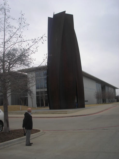 In Fort Worth we went to the Museum of Modern Art, a spectacular building with a sculpture outside made of 2” thick huge steel bent plates. We had a wonderful lunch (quiche, petite salad, espresso) in the museum restaurant, just outside a courtyard with a reflecting pool and an ingenious arrangement of Y-shaped columns supporting a thin roof. A professional dancer, with his choreographer along, was improvising and performing a dance outside between two art-exhibit trees made of stainless steel and painted silver.
 The architecture in Fort Worth and Dallas is modern and beautiful. There are lots of prefab houses along hwy I–30. The countryside is getting greener. Entry to the museum was free because it was the first Sunday of the month.
We were buffeted by trucks, especially when nearing Texarkana where we stayed at the Rodeway Inn.
Mon., Feb. 8, Day 23 98336 Texarkana to Little Rock to Memphis
Left Rodeway Inn in Texarkana in heavy rain, 37° F. Wooded area. Passed Clinton’s birthplace of Hope. Good, wide hwy with wide median and sloped shoulders. Car interior got wet in the night because of leakage beside the straps of our ski rack. We saw billboards that were either religious or ‘available’. Beautiful, tall evergreens lining hwy past intersection to Hot Springs. Gorgeous promenade, hilly near Social Hill. Temperature fell to 34° at high elevation. Snow on hwy edge, slush on road, we slowed to 60 mph. A pickup truck off road had to be righted by emergency crew. Another car and pickup off the road on the other side. Slowed to 40 mph, puddle splash, no visibility, terrible potholes, can’t see to pass and lose visibility when passed. Worse than we ever get in Canada because road not recently plowed or ever salted. Trucks exit for inspection, so that helps.
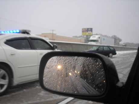 Heavy traffic 20 miles w. of Little Rock. A car does a 360 right in front of us. We pass a lot of vehicles, then are plummeted with slush by passing truck. Have to memorize road ahead in case we lose visibility. A car off on the left. We straddled lanes because of hard slush ruts. Heavy traffic both ways. Can’t switch lanes without almost losing control. We’re probably the only car with snow tires. Two cars off on left; two off on right. Managed to switch from left to middle lane. Car off on right. Going 16 mph, road very slushy. Rain splotches haven’t let up at all. Car off on left.
Exited I–30 at 1 p.m. In Little Rock. Whew! Tom didn’t get sleepy because he had to concentrate so hard on the driving. Four inches of snow on roofs of local cars. Clinton Library and Museum, in fact the whole town, closed. Kids tobogganing beside the Arkansas R., which is ful of water. We had a nice lunch of panini at the Community Bakery and Deli.
Back on I–40 at 3 p.m. in heavy rain and traffic. Car in ditch on right, still 34°. Tom makes wipers go fast when passing trucks. Car off on left. Up to 52 mph. No slush on road, then it started building up again. Trees, flat fields – the sort of landscape we’re used to near home, with far-apart farm homes. Scattered towns. All signing and hwy barriers look like ours.
The camera’s drying out (I dropped it in a puddle when getting out of the car in Little Rock). Fog. Big transport off in median. Passed a plow. Slush and ice on bridges. Temperature 36°, heavy traffic. Tom keeps two wheels on the pavement (not the slush). Car off on the left has been pulled out by now. 70 mph, than slowed to 45 mph. Lots of tracks in snowy median. Double lane line-up, mostly trucks, from more than 50 miles west of Memphis. Car off on left with someone in it. Two more cars off on left. Trees by roadside flooded. Slush makes big racket hitting underside of our car. Car off on left. Foggy again. Farm homes are mostly bungalows and many are prefabs. It has poured without let-up all day since we got up. Maybe we are traveling with the storm system from the west (El Nino). Up to 66 mph. Arrived at Memphis at 6:30 p.m. It’s beautiful!
We checked into the downtown Comfort Inn and got a room on the 11th floor with a view of the bridge over the Mississippi. It is an architectural marvel, with three high, graceful arches all lit up at night and a ‘Welcome’ sign on it. We were enchanted to look down on the marina basin, the boats going under the bridge and the street car lines going parallel to the shore, complete with swing barricades.
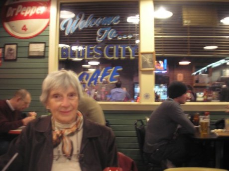 We walked out in the slush (not raining any more) to have dinner at the Blues City Cafe on Beale St (their special platter, which they let us share – a rack of pork ribs, deep-fried catfish, red potatoes, beans, coleslaw). Got ride back on trolley with talkative driver and one other friendly passenger who was flying to Chicago the next day, where there was an even worse storm predicted.
Tues., Feb. 9, Day 24 98623 Memphis to Nashville to Knoxville
Big churches, court buildings in downtown Memphis. We left town on a clear I–40, seeing many tracks on the median. Tom says tow-truckers in this area must make a fortune. Usual rural winter landscape and mixed forest but many trees are down, perhaps from an ice storm. Few cars, lots of trucks, some SUVs. One pickup off road on right. We’re wearing ski jackets and boots again. Crawled along for an hour before getting to Nashville – another car off the road.
In Nashville downtown parking arrangements were inhospitable and expensive but we got to the tourist center and walked over to see the Ryman Auditorium (not a friendly or attractive place, even if Caruso did sing there once and it’s known as the Carnegie Hall of the south. They wouldn’t let us see the interior unless we paid but they urged us to buy something in the gift shop.) We ate dinner at Jack’s Bar B Q (pork shoulder on a bun, corn, cinnamon apples) on the Main Street, which has guitar sculptures, wall frescoes and blares out plenty of country music. Inside the restaurant was some Andrew Jackson memorabilia, guns, movie star pix, etc.
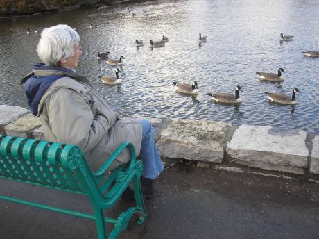
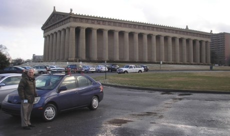 We drove over to Centennial Park and photographed a full-scale replica of the Parthenon and young Canada geese in the river.
 The city has 800 churches, publishes more bibles than any other place and is known as the ‘Buckle of the Bible Belt’. Still, we didn’t see any religious slogans posted, as in Texas.
I-40 was good en route to Knoxville as we drove by rolling hills, green and forested. I drove through a snow squall and high wind over a mountain range but our mileage picked up when the wind was in our back. Tom was at the wheel when we drove over the Appalachians at night with a 4 per cent downhill grade and big trucks at our side. The lights of the city of Harriman shone far below us on the right. It was 30° at the high elevation and 36° at the low. We changed from central to eastern time. Incidentally, Fort Knox is near here.
We chose to stay at the La Quinta Hotel in Knoxville, as opposed to the Comfort Inn, because the swimming pool looked better. However, it was too cold to use. We had an exceptionally fine dinner at Puleo’s Grille (I had crab cake, steak, side dish of mushrooms in burgundy sauce.)
 What’s in a name? Why would the building in this picture house Transylvania University?
Wed., Feb. 10, Day 25 99037 Knoxville, TN to Lexington, KY to Cincinnati and Oxford, OH
We left Knoxville in a strong northwest headwind, with gusts up to 50 mph in high mountain elevations. We passed a big white cross on a hill, just like one we had seen yesterday. A tree had fallen partly onto the road. We passed the road to Dogpatch Center.
Half way to Lexington we were traveling at 70 mph on a good road but still with big gusts and some snow flurries. Tracks across the median did not inspire confidence, nor did a pickup truck in the ditch on the right. We lost a hub cap in the awful potholes as we drove by straight-cut majestic roadside rock cliffs on both sides, like steppes. A hawk or eagle flew overhead. We were disappointed to see no horses, only fences. They say in Lexington the horses are treated better than the people so maybe they were all indoors. We passed by the opera, old Victorian mansions and office buildings. We stopped at the University of Kentucky student hangout, Tolly-Ho, for lunch and bought some postcards in the campus bookstore. Finally we saw some horses grazing outside Lexington. I drove on at 60 mph in a 70 mph zone because of the high winds. Somewhere along the way we lost another one of the hub caps which Tom had bought at El Centro and we were very proud of.
Cincinnati is beautiful but we just drove through it and got to Orie and Bernie Loucks’ house in Oxford around 6 p.m. They had had lots of snow. She served us a wonderful home-cooked dinner of beef stew, salad and fruit salad and we stayed the night and had breakfast with them.
Thurs., Feb. 11, Day 26 99350 Oxford and Columbus, OH to Pittsburgh, PA
In Columbus we got to the Museum of Modern Art just before the tuck shop (it looked like their usual restaurant was being renovated) closed at 3 p.m. and were happy to eat a sandwich of ham, salami and Swiss cheese on rye and drink orange juice. No time to look at pictures, and the admission would have been costly. We had supper at a very modern McDonalds in Washington, PA and arrived at Leslie’s house around 8 p.m. after a scenic drive over rolling hills. They had had a tremendous amount of snow but were happy to see us, and vice versa.
Fri., Feb. 12, Day 27 Pittsburgh
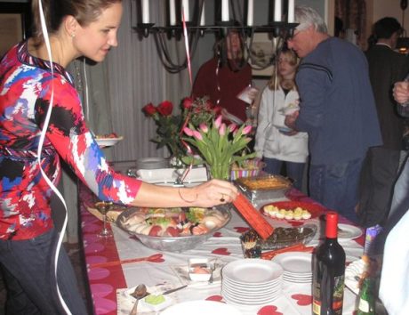
We went out to buy last-minute items for the party Barb was planning and bought ourselves a chocolate strawberry filled with liqueur. Then we went out again, to stay out of the way of the cleaning woman, and had coffee and sweets at Starbucks while reading the New York Times. Barb came home early from work to start cooking and Monica and I helped her. Tom spent hours shovelling the driveway and doing chores while Leslie was at work.
Sat., Feb. 13, Day 29 Pittsburgh
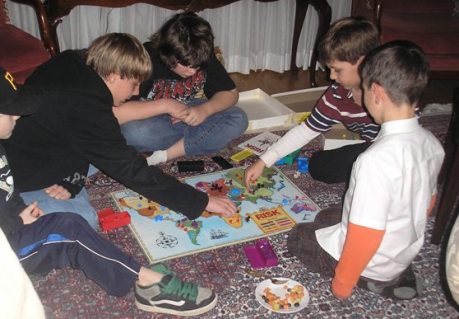
We took our grandsons out for lunch at McDonald’s. About 50 people, adults and children, came to the party which was a huge success.
 Sun., Feb. 14, Day 29 Pittsburgh to Ottawa
We drove home and were very sad to find that our favorite stop on this trip, the Plainville Farms Restaurant in Cicero, NY had closed permanently. Instead, we ate at Denny’s.The weather was good and we arrived just before midnight.
So little snow had fallen, we didn’t even have to clear the driveway. The plants survived our absence and we are very happy that this major dream trip turned out so well. We did everything we wanted to do on schedule, had wonderful visits with our friends and relatives and have lots of stories and pictures to share with our friends. Driving under winter conditions focuses the mind so I think that was good mental exercise for us indeed. It is nice to be able to see the Massetts again and to talk to Paula by phone.
100,290 miles on the chronometer
Happy Reading & Traveling from Cozy Book Basics and Bliss on Wheels!
We are octogenarian writers who like to travel by car and share our adventures. We hope you enjoyed our notes and pictures of this cross-continent road trip as much as we enjoyed it on wheels six years ago.
http://www.cozybookbasics.wordpress.com
http://www.amazon.com/author/margaretvirany

Reblogged this on insaneowl.
LikeLike
Thank you, Fiza. We live in very different worlds but I can always depend on you to watch what is happening here.
LikeLiked by 1 person
News update on this blog post: We crossed over the two-lane bridge at Nipigon, the only way to connect one half of Canada with the other without going through the United States. As of this update in Jan., 2016 a new bridge described as a ‘$106 million crown jewel’ by the National Post and opened two months ago was embarrassingly damaged when “a section of the cable-supported bridge deck suddenly split apart and heaved upward by 60 centimeters or more.” It has been reduced to one-lane traffic at the moment.
LikeLiked by 1 person